
All popular belief seems to point to a southerly setting current. What evidence was there to prove such a thing?
Before the days when ships began polluting Earth’s atmosphere with the fumes from burning carbon fuels - before the days when her seas became polluted with the noise of a million propellers ; seafarers exclusively used the physics of nature in the form of the wind to navigate this wonderful world of ours. They also used their brains to develop instruments to help them travel the shortest distances between destinations. However, these instruments too were in harmony with nature because it did not require energy (except the human kind) to use them. I refer of course the compass and eventually the sextant.
Unfortunately for mother earth, these methods of travel had one over-riding limitation - the fact that the wind was never constant; either in force or direction. There were a few locations on the surface of the sea over which the wind would blow in a fairly constant direction and force for a few months each year - hence the name ’Trade Winds’. Elsewhere, the mariner had to resort to ’tricks’ of his trade. One of those being Parallel Sailing.
Most of the senior and even some of the junior officers involved in the Titanic saga had the dubious pleasure of being there at the end of the era of commercial sailing ships. All had been trained on sailing ships and all were comfortable with the art of Parallel Sailing.
So what is ‘Parallel Sailing’?
As many know, a marine chart is sub-divided by vertical and horizontal lines. The vertical ones are the Meridians of Longitude and the horizontal ones, the Parallels of Latitude. The former run N-S and the latter E-W.
Before the advent of power-driven ships, sailors would , as far as practical, sail along convenient Lines/Parallels of Latitude between destinations. They knew that such Lines eventually crossed, or passed close to, land and therefore could be used as a course line or track to be followed with confidence. This meant that it was most important to know what Line of Latitude they were on at a given time. The sextant and its precursors were developed with the initial purpose of finding this out.
To find a Latitude, sailors used (and some still do) the sextant to measure the meridian altitude (height)of a celestial body - mainly the sun at mid-day or the Moon, star or planet at dusk or dawn. ‘Meridian Altitude’ is just a fancy way of saying ‘measuring the angle in degrees between the horizon and a celestial body at it’s highest altitude above it. Since celestial bodies rise in the east and set in the west, this would be when the body was due north or south of the person observing it. That’s why the Pole Star which is almost due north was always very useful.
Longitude was a different ‘kettle of fish’. To find out the Longitude of his position, a sailor needed- as well as his compass and sextant - the help of a very accurate clock - a chronometer in fact. Even this could prove dodgy if the chronometer had an unknown error preventing it from showing the exact time at a particular place on the surface of earth. In the case of Californian that place would be Greenwich in the UK.
The foregoing is an extremely simplified description of finding a ship’s position and I hope that any skilled navigators or purists reading this will forgive such simplicity if not anything else to follow. I chose this way of explanation for those individuals who may not be a budding Vasco da Gama.
Actually, the subject of Parallel Sailing was the very thing that made me think about what might have been in Captain Lord’s mind regarding the navigation of Californian up until his ship was stopped by ice at 10:21pm on 14th of April, 1912 .
Since it seems the latitude of Californian did not change from the time the ship turned onto a westerly heading at 09:40 am on the morning of the 14th until 10:21 pm.; anyone might be forgiven for thinking along these lines (forgive me again!).
Consider the evidence:
A ship being steered for Boston from The Corner would normally head on a course of 271T. (N89W) but Californian's course varied little from due west - 270T. How do we know this? Fortunately, Mr. Stewart, the Chief Officer recorded the compass error in the Ship’s logbook. It was made up of two elements - 24.5 W Variation and 5.5W Deviation. These two are added to give a total error of 30 degrees West. This westerly error must be added to Steering Compass courses measured West from North and subtracted from those measured West from South to arrive at the proper or ‘True’ course. This True course can then be drawn on the captain’s chart to show a line, along which the ship is ‘truly’ travelling. Incidentally; if the error is ‘W’, it is always subtracted from courses given in 360 degree notation.
The ship’s course was altered to N60W by compass at 9:40 am. 15 minutes later- at 09:55 am., it was altered again, this time by one degree to the northward which was N59W by compass (the course for Boston). The course was changed again to N61W according to the ship’s logbook at Noon on that day - an alteration of 2 degrees to the southward of the course for Boston. We know it didn’t change thereafter because Captain Lord stated that his ship’s head by compass just before stopping at 10:21 pm that night was still N61 W.
Possibly Captain Lord initially thought he was at the position of The Corner -42.00N..47.00W. So what made him steer West first then alter a degree to the north at 0950 then alter back to a degree south of West at Noon? An adjustment for compass error? Deviation was quoted as 5 degrees then 5.5 degrees West. Variation might have been greater than the quoted 24.5 degrees West. Indeed there is evidence elsewhere which suggests it was greater than 25 degrees West at midnight on 14th April,1912 in Longitude 50.00W.
Whatever the reason for the alterations - they worked because if, Lord initially intended to sail direct towards Boston then changed his plan to sail along the parallel of 42.05N after finding himself on that line at Noon he succeeded. And the compass error was 29W not 30W. Californian’s Latitude did not change from Noon until the vessel stopped at 10:20pm. The principal evidence pointing to this is the latitude by meridian altitude of the sun at Noon on the 14th and later, the Latitude by altitude of the Pole Star ( Polaris) calculated at 1930 by Mr. Stewart. Both gave a latitude of 42.05N - proving that the ship had not deviated north or south of that east west course.
It has been suggested that Stewart’s Polaris observation at 7:30pm. was ‘opportune’. I see no sound evidence proving that this was the case. As I have pointed out; every navigator will bear witness to the fact the a noon Latitude by sun’s meridian altitude was normal practice in every ship at sea. Equally, Pole star observations were taken at every opportunity since they were and still are one of the simplest, quickest (sextant) methods of establishing Latitude in the northern hemisphere.
What about Longitude then?
It will be recalled that Lord stated his ship was making an ‘average speed’ of eleven knots. This was the speed expected at a given coal consumption. Obviously they were operating at optimum levels given the then recent problems with coal supply.
In these days, it was a regular practice to use approximate equations to calculate coal consumption relative to ship’s speed. However the equations were fairly rough; they depended much on experience and experiment and were extremely sensitive to coal quality as well as other variables such as engine design, weather conditions and even bad steering.
They were based on the principals that consumption of coal varies approximately as the cube of the speed and also as the speed squared times the distance. Incidentally; such equations were only good for speeds up to 14 knots.
To date, researchers have kept to Lord’s’ average speed of eleven knots. I am of the opinion the ship was making closer to 11.25 knots. I believe this because of the two DR positions reported at 6:30pm. and at 10:20pm. The first gave a Longitude of 49.09W and the second a longitude of 50.07W. This is a difference in Longitude between these positions of 58 minutes which at Latitude 42 N converts to a distance of 43.1 miles. This distance was covered in 3hours 50 minutes, producing an average speed of 11.25 knots.
If we apply this speed to the lapsed time between Noon and the time of stopping -
10 hours 20 minutes we find the vessel had travelled 115.9 miles. This distance gives a difference in longitude of 2 degrees - 36 minutes which subtracted from the 10:20pm Longitude of 50.07W gives a Noon position of 42.05N…..47.31W.
However, Captain Lord stated the ships time was for 47.25W., suggesting this might also have been the Noon 14th. Longitude. I don’t think so!
Longitude 47.25W is 6 minutes of longitude east of my calculated Longitude of 47.31W. The difference of 6 minutes of longitude at 42N is equal to a distance of 4.5 miles - adding this to the already calculated distance of 115.9 gives a total distance of 120.4 miles. This is the distance between Lord’s Noon Longitude of 47.25Wand stopping at 50.07W. Californian would need to have been travelling at 11.7 knots to cover such a distance from Noon to 10.20pm. I do not believe Californian ever attained that speed before 6:00am on the morning of the 15th. When Lord thought he was going to the aid of ’Titanic’.
However I do believe that Captain Lord found his average speed was about 11.25 knots at Noon. Proof of this is the DR Longitude he broadcast in his ice warning later that day at 6.30pm. Six and a half hours from a Noon Longitude of 47.31 W at a speed of 11.25 knots gives a DR Longitude of 49.09W - the DR associated with the 6:30pm ice warning sent by Californian BEFORE there was any alleged or suggested need to ‘cook the books’.
So what was the correct Noon Longitude? I propose that it was indeed 47.31W.
Why did Captain Lord later refer to the Longitude value of 47.25W. ? Was he was in fact quoting ship’s dead-reckoning(DR) Longitude (ship’s time)for Noon that day - calculated using a coal consumption indicated speed of 11.0 knots from the reference Longitude of ‘The Corner’ 47.00W? Perhaps he had a large chronometer error and used time zone Noon Latitude as a Noon DR? - Since 15 degrees of Longitude = one hour of time - 1 degree = 4 minutes of time. Therefore 1 minute of Longitude = 4 seconds of time. It follows: 6 minutes of longitude might be due to a difference or error in chronometer time of 24 seconds. Such an error would be unforgivable later when chronometers could be checked by wireless transmitted GMT time signals but Lord would closely compensate for it at DR Noon by another ’trick’ of navigation using position lines and intercepts - but that’s another story!
So it seems Californian was travelling at about 11.25 knots and the Noon Longitude was close to 47.31W.
To summarise:
I believe Captain Lord had a good idea that his ship was travelling faster than 11 knots relative to coal consumption and had no intention of sharing this intelligence with his owners - keeping that little bit of advantage ‘up his sleeve’ so to speak.
Further; since the Latitude of Cape Cod is 42.05N - I also believe that he fully intended to turn onto that latitude and sail along it until within sight of Cape Cod before turning north for Boston.
I think he became suspicious about actual speed fairly early on. Possibly Mr. Stewart had a dawn ‘Fix’ indicating the ship was further south than she should be. Additionally; patent log readings would indicate that his ship was travelling faster than coal consumption suggested.
The weather was fine - ideal for Noon sights so he was comfortable with the knowledge that within three hours after turning, he would get an accurate fix. Then he would know, more-or-less, exactly where he was. He would have his speed confirmed on this new course and get a good check on compass error. More important - he would be able to adjust his course direct for Boston - or continue west toward Cape Cod.
There is, however, a twist in the tale. The maintenance of a due westerly course creates an enigma. The latitude of Californian at Noon and again 7.5 hours later at 7-30pm - both confirmed by celestial observation - DID NOT CHANGE!
The difference in one degree between a heading of West (270T) and 269T should have resulted in a difference in latitude of 1.5 minutes in 7.5 hours therefore the latitude at 1930 should have been 42.03.5N. Obviously Lord or Stewart expected this. It will be recalled that this DR latitude was given in a radio warning as part of a the ship’s DR position when passing ice about 6-30pm that evening. It was later amended to 42.05N.
Captain Lord must have been confident that the course and speed being made good was N90W True at 11.25 knots respectively, since he used 42.05N..50.07W as his DR position when he stopped Californian at 10:20pm that night.
So- was there a south-setting current that night?
All popular belief seems to point to a southerly setting current. What evidence was there to prove such a thing? None of the navigators involved refer to making a course allowance for a current setting south at up to one knot.
A vessel wishing to maintain a course of West (N90W) at 11.25 knots that night through a south setting current of 1 knot would have had to steer N55W by compass to make good her intended track. Indeed, some researchers have suggested that Californian’s Latitude was 42.01N at 10:20 pm when she stopped. This would indeed be correct if there was a 1 knot current setting her southward from around 7:30pm.

Sketch (not to scale) showing track of Californian during the evening of 14th April,1912. Also showing suggested track of Parisian during same period.
Actually; if the Navigation of Californian was accurate; there might even have been a slight northerly set to the current. However with such a minor difference between the ships intended course and the course made good - bad steering together with rounding-up or down of compass error fractions could easily explain things.
Mr. Stewart re-enforces this possibility. When asked at Q8713 : “do you know what the deviation of your compass is?” he answered : “about 5 degrees I believe - 5-½ degrees, I believe” - and later , in answer to Q8715: “about W.”
Indeed, the experience of Californian suggests there may not having been a current that night or one so slight as to be almost indiscernible. So let’s examine what additional evidence or lack of it there may be available.
Consider the evidence of the various ships which reported ice fields that day.
As can be seen above , the field of ice encountered by Californian was the same as the one encountered by Trautenefels. That vessel met with the ice field at 5.00am on the morning of the 14th - 17 hours earlier and a mere four miles south of where Californian’s reportedly met it. It would seem that particular pack had not moved east or west by very much if at all during that time. So there seems not to have been an east-west movement of the pack.
Trautenfels then had to steam about 20 miles or more southward to find a way round it.
More than twelve hours later - at around 10:00p.m. that night - Parisian also had steamed south before fining a path through the ice. She found it at the same place as did Trautenfels. So there was little or no north-south movement of the ice.

Sketch (not to scale) suggesting tracks of vessels using clear passage-way through the southern extension of the Ice Pack during 14th and 15th April, 1912.
From Ice Reports supplied by the USN; no less than eight ships used this passage through the pack ice within a 36 hour period. Indeed, it is possible Californian had used that particular relatively clear area twice within 4 hours -the second time next day at Noon - over 24 hours after Trautenfels and the others had used it. The point being; if all these ships were able to pass through in roughly the same area over such a length of time - the ice could not have been moving very much - if at all. The track used was probably less than five miles wide. The whole area would have been much further south within 12 hours if the suggested current rates are to be believed.
There is other less tangible evidence of lack of current.
Normally a ship-shaped floating object , when stopped, will adopt a beam (side)-on attitude to wind and or current. This is one of the reasons why life boats are equipped with sea anchors - to hold the boat’s head (or stern) in the direction of the influencing forces. It is well documented that Californian swung through at least 180 degrees that night. This would not have been the case if there had been a current. It is more probable that she would have swung to head about east, then stopped swinging when the port side of the stern was presented broad-on to the current.
I hear the question: “what about the survivors then? They were found well south of the wreck site.”
To that I would answer with an example:
Think of a small pleasure boat the same length as one of Titanics’ lifeboats but give it a side 6 feet high for the full length. Then think about how such a boat would move - even in a 15 mph wind. Anyone who has ever tried to hook-on to a mooring buoy in such a craft can well imagine what I am describing. Some of these boats were drifting in the wind for up to two hours.
OK! Where does that leave us? Was Mr. Stewart the ultimate ‘book-cooker’? or arch-forger? It will be remembered that such an idea was hinted-at during the BOT Enquiry:
After Q 8705 : The Commissioner to the Attorney General : “I would like to understand as we go along. Do your questions suggest this log has ben doctored?”.
The Solicitor General replies at Q 8707 : “I am making no such suggestions……”.
If Stewart did not cook the books then there was little or no current that night and Californian was indeed where Lord said she was. It follows then that it is inconceivable that the ship seen by Lord’s 2/O bearing SE (135 T) was the Titanic. Similarly: Groves’s 3.5 point abaft the beam (173 T) vessel could not have been Titanic either! Further more, Titanic would not have drifted south after impact but would have stayed more or less at the point she finally came to rest. It is more probable that she would have behaved in much the same way as did any of the other vessels stopped in the area.
It is therefore highly unlikely that she would have remained - as has been suggested- for over two hours pointing north or nearly north - even more so if there had been a south-running current
If, in addition to there being no surface current and the deep current was minimum or even non-existent; that would suggest Titanic sank not far from where she came to rest on the sea-bed. This in turn, would mean that the distance between Californian and Titanic was nearer to 23 miles.
I think there has been a Labrador Current - Gulf Stream mind set at work. These two major currents undoubtedly played principal roles in the ice movement at the time. However, the very fact that the ice was seen so far south should have caused serious thought.
The ice would not continue to move south much longer than it had so far done. There would be a time when both these currents cancelled each other out and a sort of still water area would be formed - briefly before the stronger component took over. I suggest this is perhaps what was happening around latitude 40.35North.
This was an unusual occurrence - it was not by pure arbitration that the Latitude of 42 N. was chosen as the southern track. Nor was the choice of 47.00W as its eastern limit.
The foregoing does not deter from the fact that personnel on Californian did see pyrotechnics in the early ours of 15th. April. However, I suggest it supports the evidence of those branded as incompetents and unravels the accusations of callous indifference levelled at a certain individual.
Eastward 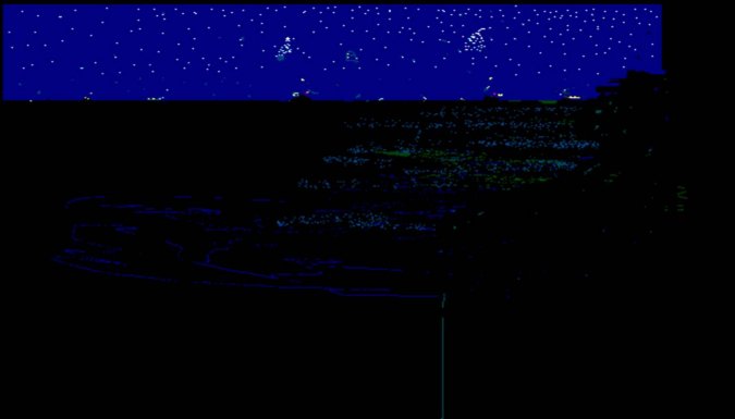 Westward
It is patently obvious to anyone who has ever been at sea that ship’s lights seen at the distances suggested by this argument would be almost indiscernible - even on a night such as it was then. I have got out my paint-box and attempted to convey to the lay-man just what it might have looked like to the ‘dark’ gent situated on the west side of the above sketch.
On the Eastward side; we see a vessel approaching from the ‘Eastward’ as Captain Lord suggested. First at about 12 miles, then 7, then 5 then finally between 5 and 7 miles and turned to head about NNW . I then show two things:
- That vessels firing a rocket from the region of her starboard bridge and
- A rocket seen not quite as high as her steaming light seemingly from a vessel on the horizon beyond.
On the Westward side, I have then tried to depict what the 3rd. Officer - Mr. Groves described - a passenger vessel showing two masthead lights and a red side-light, 9 miles away and approaching obliquely from about 3½ points abaft the starboard beam. Then we see the same vessel’s bearing slightly change until she is about 5 to 7 miles away, stopped bearing about SSE and showing her red light. I have also tried to depict a rocket fired from that vessel.
Since it has been suggested this was Titanic and she stopped in that position; I have depicted what rockets fired from that ship might have looked like.
However, this could not have been Titanic if Mr. Groves correctly described what he saw. A vessel showing a red light and approaching ‘obliquely’ to the fore and aft line of Californian from 3½ points abaft the starboard beam when Californian was heading NE, must have been heading between N by E and NE by N If that vessel was approaching ‘obliquely’ from the Eastward she would have been showing a green side light. Mr. Groves stated emphatically that he never saw a green light.
I think the evidence of Mr. Groves bears closer scrutiny - perhaps later?
Finally; I have tried to depict what a rocket might look like at extreme range - slightly south of SE on an observer’s horizon.
In the foregoing sketch, I have deliberately excluded the low altitude stars for clarity. Obviously, if they were included, they would confuse the eyes of an observer. Since it was an exceptional night - I suspect this confusion would be intensified by lots of star light reflected from the smooth mirror-like surface of the sea. It is this, if nothing else which angers me about assumptions of culpability made by historians who have never witnessed such a phenomenon. The lads on the exposed bridge of Californian that night did not easily and clearly recognize what they were seeing. Academics can doubtless prove the physics and math of how an object should look given a set of circumstances but how many of us- having seen something for the first time ‘in the flesh’ so to speak - have exclaimed “so that’s really what it looks like?”
Stone and Gibson had doubtless seen many different types of rocket signals of all colours heights and intensities. Several Marine Manuals had previously contained whole sections dealing with all the various ones to be seen at sea. Surviving witnesses from Titanic described the distress rockets in several different ways - these included ‘experts’.
Basically; something unusual was seen at the time, that ‘thing’ did not convey sufficient urgency to Stone and his Apprentice. They saw it again at around 0330 am and still it did not convey urgency.
I am therefore puzzled as to why successive authors have not condemned them for not calling the Master, starting up engines and shooting off to the south when they saw the second set of rockets. I suspect that everyone involved in this particular part of the affair have been wise after the event in various degrees of intensity - and that particularly includes Messrs Groves and Gibson.
I will end by reiterating my belief that there is sufficient evidence to suggest there was little or no current that night. If this can be confirmed then the ‘finger pointers’ must surely go back to their respective ‘drawing boards’.

Comment and discuss